Tampa’s skyline didn’t exist a century ago. What started as a phosphate-shipping port on the Hillsborough River has grown into a city of 400,000 people, with high-rises pushing into the downtown core and expansions spreading across the Carrollwood and Westshore districts. That growth collides daily with the geology underneath: a mix of Pleistocene sands, stiff silts, and the unpredictable cavities of the Floridan limestone aquifer. When a project cuts 30 feet into that profile, the ground doesn’t just sit there — it reacts. We monitor that reaction with real-time instrumentation, because in a city where the water table can sit barely four feet below grade, the margin for error on a braced excavation is zero. A deep excavation without live monitoring in Tampa is a bet against the water table, and the water usually wins.
In Tampa’s high-water-table geology, 48 hours without monitoring data is enough time for a braced excavation to go from stable to emergency.
Our approach and scope
Our field kit includes wireless tiltmeters, crack gauges on adjacent structures, and optical survey points on every corner of the shoring. Every instrument is calibrated against ASTM D7299 for inclinometer verification. We don’t rely on a single data source — cross-checking tiltmeter trends against piezometric levels catches false alarms and confirms real problems. In the Ybor Channel district, where old fill overlies organic silts, we’ve learned to set tighter trigger levels because those soils creep long before they fail.
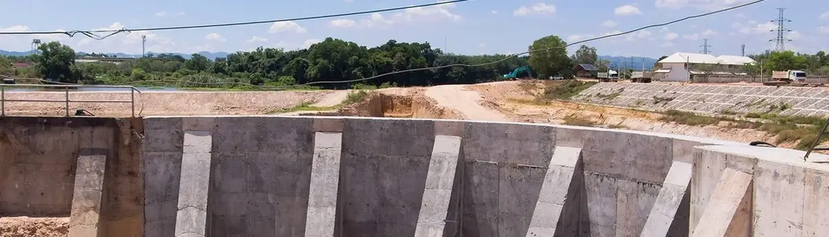
Site-specific factors
The soil profile changes dramatically across Tampa. In New Tampa, you’re dealing with well-drained sands that stand up reasonably well in dry conditions — but they lose cohesion fast if a summer storm saturates the face. Over in the Port Tampa area, the subsurface is a layered mess of dredged fill, bay mud, and weathered limestone. We’ve watched excavations in that zone where the same wall design that worked in Westshore started deflecting three times the predicted amount because the fill layer was thicker than the borings suggested. The biggest risk isn’t just wall movement — it’s the impact on adjacent infrastructure. A 0.5-inch settlement under a 1920s masonry building on Kennedy Boulevard can turn into a six-figure claim overnight. Karst cavities add another layer: a piezometer reading that drops suddenly can signal a sinkhole connection opening up. Without continuous data, that signal gets missed until the ground surface tells the story in the worst possible way.
Reference standards
IBC 2024 — Chapter 33 (Safeguards During Construction) for excavation protection requirements, ASCE 7-22 — Section 31 (Earth Retaining Structures) for lateral earth pressure design loads, ASTM D7299 — Standard Practice for Verifying Performance of Vertical Inclinometers, ASTM D2487 — Unified Soil Classification System for logging all monitoring boreholes, OSHA 29 CFR 1926 Subpart P — Competent person requirements for excavation safety on monitored sites
Other technical services
Automated Real-Time Monitoring Systems
Wireless inclinometers, piezometers, and crack gauges with cloud-based dashboards. Alert thresholds are set per soil zone — sandy formations get tighter movement limits in wet season. We handle installation, calibration, and daily data review.
Manual Survey & Baseline Documentation
Pre-construction condition surveys of all structures within the zone of influence. Optical monitoring with total stations and precise leveling on settlement markers, referenced to stable benchmarks outside the excavation footprint.
Typical parameters
Common questions
¿What does geotechnical excavation monitoring cost for a typical Tampa commercial project?
Budget between US$850 and US$2,230 per month depending on sensor count, telemetry requirements, and whether you need real-time versus weekly manual readings. A basic setup with four inclinometer casings and six settlement markers falls on the lower end; full automated systems with vibrating-wire piezometers and live dashboards push toward the upper range.
¿How often is monitoring data reviewed during active excavation near the Hillsborough River?
On high-water-table sites close to the river or bay, we review inclinometer and piezometer data daily as a minimum. During tieback installation or heavy rainfall events, we switch to real-time telemetry with alerts sent directly to the project engineer and superintendent. The frequency drops to weekly only after the permanent structure is backfilled and movement has stabilized for two consecutive weeks.
¿What triggers a monitoring alert on a Tampa excavation with karst risk?
We set dual triggers: a lateral movement rate exceeding 0.25 inches per day on any inclinometer, and a piezometric pressure drop exceeding 2 psi in 24 hours — the latter often signals a void connection opening in the limestone. If either trigger fires, we recommend a visual inspection of the excavation face and adjacent structures within four hours, plus a resistivity or GPR scan if sinkhole activity is suspected.