Across the Tampa Bay area, the subsurface is rarely straightforward. We see it time and again on job sites from Westshore to Brandon—what looks like stable sand can hide irregular limestone pinnacles, buried debris, or a paleosinkhole just a few feet down. Standard borings miss these features if they fall between the grid points. Seismic tomography fills that gap by sending energy through the ground and recording how it bends or bounces off buried structures, producing a continuous 2D or 3D velocity image. When the target is deeper, we complement the refraction data with a reflection survey to catch impedance contrasts at depths beyond 100 feet. The result is a detailed map of rockhead topography and anomalous zones before the excavator ever moves in.
Tomographic inversion resolves velocity gradients within Tampa's irregular limestone, catching features that conventional refraction layer models smooth over.
Our approach and scope
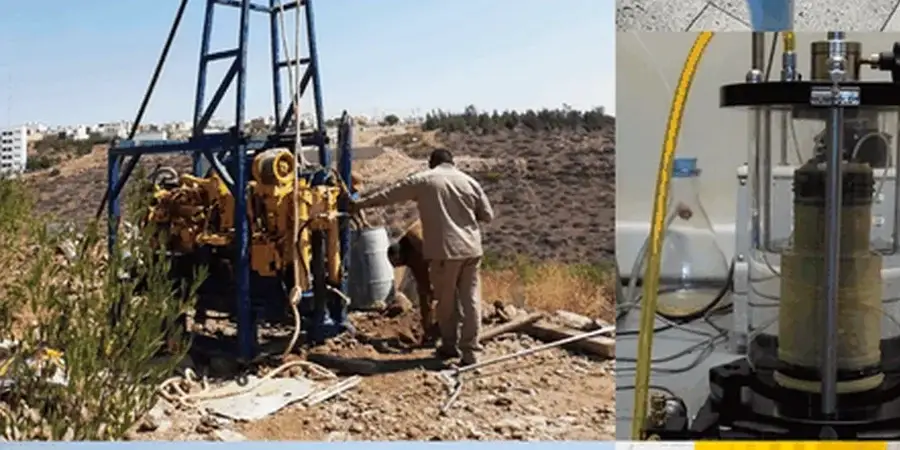
Our field crew deploys 24- or 48-channel seismographs with 4.5 Hz geophones at spacings as tight as 5 feet, depending on the resolution the project demands. Shot points are stacked vertically to improve signal-to-noise ratio in the urban noise environment along Dale Mabry Highway or I-275. Post-processing uses tomographic inversion rather than simple delay-time methods, so we resolve velocity gradients—not just discrete layers. This matters when the limestone itself grades from weathered to sound rock over a short lateral distance. All acquisition and interpretation follow ASTM D5777 and D7128 guidelines, with results keyed to the site classification requirements of ASCE 7 and the Florida Building Code.
Site-specific factors
The risk profile varies dramatically between South Tampa's sandy coastal plain and the clay-rich uplands around New Tampa and Wesley Chapel. South Tampa sites often sit on a thin quartz sand blanket above the limestone; here, the primary hazard is a paleosinkhole chimney that hasn't expressed at the surface yet. Refraction tomography catches these as a localized velocity low extending downward. In New Tampa, the overburden is thicker and more clay-rich, so the risk shifts toward differential settlement where the limestone surface drops off abruptly. A few test borings alone won't show you whether the rockhead between them is flat or resembles a roller coaster. The continuous velocity section from a tomography line answers that question. Ignoring this step can lead to very expensive foundation redesigns once the earthwork contractor hits something unexpected at the bottom of the excavation.
Reference standards
ASTM D5777 – Standard Guide for Using the Seismic Refraction Method, ASTM D7128 – Standard Guide for Using the Seismic Reflection Method, ASCE 7-22 Chapter 20 – Site Classification Procedure for Seismic Design, Florida Building Code 2023 – Section 1803 Geotechnical Investigations
Other technical services
Seismic Refraction Tomography
Best suited for mapping top-of-rock and identifying sinkhole-prone zones within the upper 100 feet. We use tomographic inversion to produce a smooth velocity model that reveals both layering and lateral variations—critical when the Hawthorn limestone transitions from weathered to competent over short distances.
Seismic Reflection Profiling
Deployed when the target horizon lies deeper than refraction can reach, or when we need to image a specific impedance contrast such as the base of a confining unit. Reflection data complements the near-surface velocity model and ties directly to boring logs for stratigraphic calibration.
Typical parameters
Common questions
How much does a seismic tomography survey cost in Tampa?
For a typical Tampa site requiring 4 to 6 refraction lines with 24-channel acquisition, budgets usually fall between US$2,610 and US$4,910. The spread depends on total lineal footage, the number of shot points, and whether reflection profiling is added. We deliver a fixed-price proposal after reviewing the site plan.
How deep can seismic refraction see in Florida limestone?
With a 48-channel spread and a 20-foot geophone spacing, refraction can typically image to roughly 80 to 120 feet in Tampa's limestone, assuming the rock velocity increases with depth. If the limestone surface is highly irregular or velocity inversions exist, we combine refraction with reflection or MASW to avoid interpretation gaps.
Does the method detect sinkholes before they open at the surface?
Yes, it is one of the few non-invasive methods that can. A raveling zone or sediment-filled chimney shows up as a distinct low-velocity anomaly within otherwise competent limestone. We have mapped these features across Hillsborough County, often correlating them with GPR anomalies and CPT refusal depths.
What is the difference between refraction tomography and standard refraction?
Standard refraction assumes discrete, flat layers and produces a layered model. Tomographic inversion divides the subsurface into thousands of small cells and solves for the velocity in each cell simultaneously. This captures gradational boundaries—like Tampa's weathered-to-sound limestone transition—and lateral velocity changes that a layered model would miss.
How do you handle background noise near busy roads like I-275 or the Selmon Expressway?
We stack multiple shots at each source point to improve the signal-to-noise ratio, and we schedule acquisition during quieter windows when possible. Our seismographs also record ambient noise before the shot, which lets us filter traffic rumble during post-processing. The result is clean first-arrival picks even in Tampa's busiest corridors.